


Étape 1 Saint Gilhem

Roger Philippe Wallez
User GUIDE

Length
17.1 km

Max alt
1197 m

Uphill gradient
315 m
Km-Effort
21 km

Min alt
1015 m

Downhill gradient
179 m
Boucle
No
Creation date :
2024-05-12 11:25:19.0
Updated on :
2024-05-12 16:14:37.595
4h48
Difficulty : Very difficult

FREE GPS app for hiking
 SityTrail
IGN / Geographical institutes
SityTrail Plus
The world is yours!
About
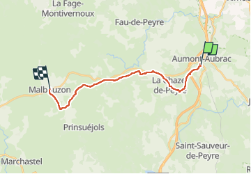
Trail Walking of 17.1 km to be discovered at Occitania, Lozère, Peyre en Aubrac. This trail is proposed by Roger Philippe Wallez.
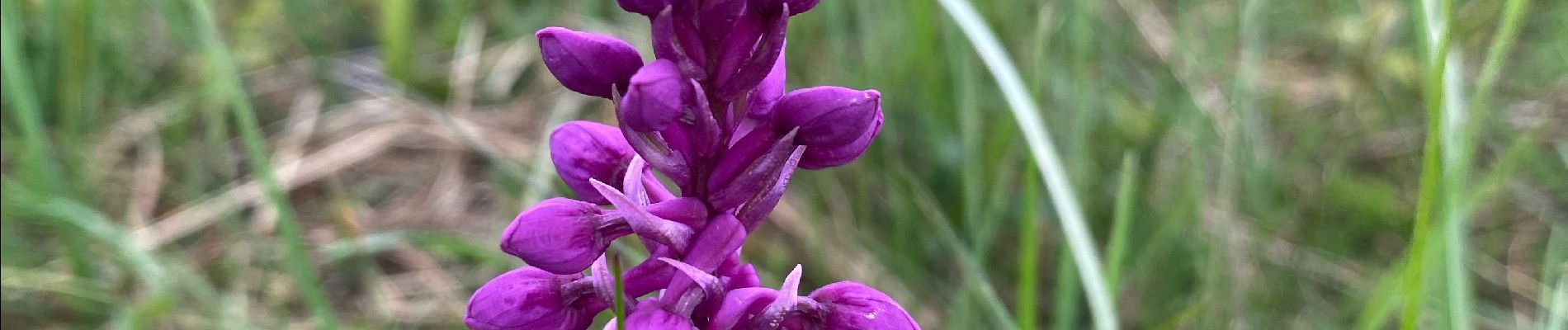
Photos


Positioning
Country:
France
Region :
Occitania
Department/Province :
Lozère
Municipality :
Peyre en Aubrac
Location:
Aumont-Aubrac
Start:(Dec)
Start:(UTM)
522460 ; 4951711 (31T) N.
Comments